The history and theory of satellite navigation

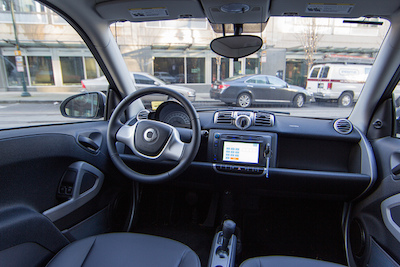
Satellite navigation systems, or sat navs for short, are transforming the way we live. We can travel to new places without having to consult a map or ask for directions. Long journeys seem less daunting, and traffic jams can be avoided. Satellite navigation technology is even at the forefront of the development of automated, self-driving cars. As effective as sat nav systems are now, it seems that they’re going to become even more powerful and useful in the future.
It’s amazing to think that this wonderful technological breakthrough has only been available to the general public since 1994. Here’s a look at the history of satellite navigation, and the theory behind it.
Early positioning systems
The very earliest positioning systems, as we would understand them today, used earth placed radio transmitters rather than satellites. A huge step forward occurred in the 1960s when Transit became the first satellite based navigation system. It was developed at a huge cost and used by the US military.
This system worked by using the DopplerEffect to calculate the position of the receiver in relation to satellites. Satellites followed fixed trajectories at calculable speeds, so scientists used this knowledge to determine position based upon short term variations in frequency. This laid the basis for the satellite navigation systems we use today. Modern systems are increasingly complex, and yet they can be bought and used by the person in the street.
The advent of the Global Positioning System
GPS is the standard used in most sat nav systems. It’s incredibly reliable, and results can be obtained at lighting speeds, even in remote areas of the world. GPS navigation was first used in 1978, but wasn’t available to the public until 16 years later. The GPS system uses between 24 and 32 medium Earth orbit satellites that are following six trajectories. A precise mathematical formula allows them to determine the location of a receiver with incredible accuracy, even when the receiver is moving at high speeds.
By calculating position based upon several satellites at the same time, the likelihood of errors is greatly reduced. Kalman filtering also helps to create a supremely reliable result.
Military uses for satellite navigation technology
We’ve all become familiar with satellite navigation for our cars, but it’s also providing benefits for the military. Satellite navigation is used for guided bombs and target location. It’s a controversial usage, but one which contributed to the invention and development of sat nav technology.
Civilian usage
With sat nav technology becoming smaller and more portable, it’s now ideal for civilian use as well.
GPS receiving wrist bands are often used by joggers and walkers, to calculate how many steps they’ve taken, and how many calories they’ve burned. These sophisticated systems feed back vital information to the user, and are increasingly used for personal fitness regimes.
Sat navs are also being used by cyclists, both amateur and professional. When a cyclist has a lightweight carbon fibre bike, and the latest cycling clothing, there’s one thing they need to complete the look. A cycle satellite navigation system. They not only prevent cyclists from getting lost, and open up the possibility of cycling in new and unfamiliar territories, they can also calculate speed with precision not seen on traditional speedometers, and calculate distance covered and calories used. This kind of information is of great use to cycling enthusiasts.
So where will satellite navigation go next? The self-parking cars give us a real glimpse into the future. Automobile manufacturers are already building cars that drive themselves, using satellite navigation. The future could be much closer than you think.
The editorial unit


Facebook
Twitter
Instagram
YouTube
RSS